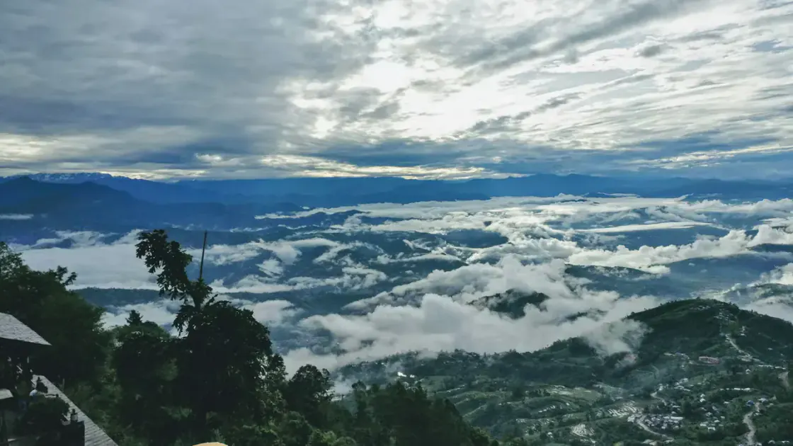
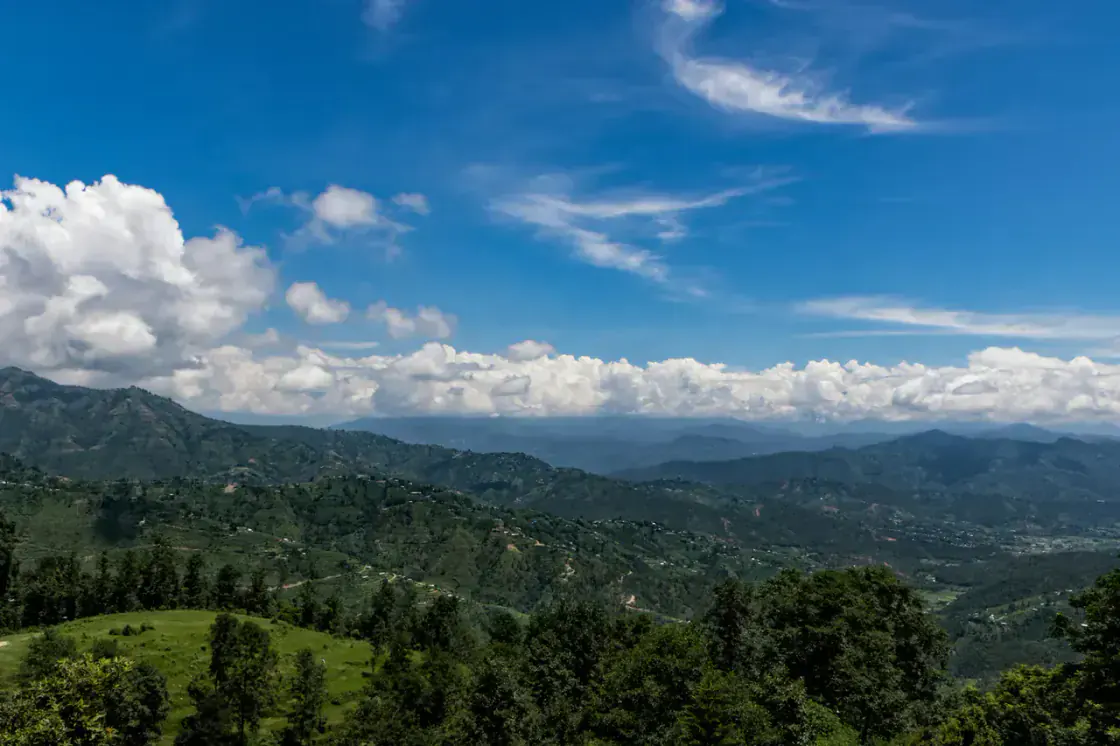
Mustang high desert road journey in Nepal

Mustang, Nepal

Nepal's Ultimate Himalayan Road Journey

Mustang is one of Nepal's most unique Himalayan regions, known for remote roads, Tibetan-influenced culture, dramatic high-desert landscapes, bike trips, jeep travel, and routes toward Upper Mustang and Lo Manthang.

Best riding season

Mar-May, Sep-Nov

Altitude range

800 m to 3,800 m+

Travel style

Bike, jeep, road, guided

Permit requirement

Upper Mustang restricted

Road difficulty

Dusty, rough, windy

The Mustang experience

A journey where road, wind, altitude, and silence become the story.

Mustang does not feel like Nepal's greener middle hills. The route becomes rougher, drier, wider, and more exposed as travelers move deeper into the Himalayan desert.

Long Himalayan Road Days

Mustang is not a soft sightseeing loop. The journey is built from distance, dust, switchbacks, river corridors, wind, and altitude.

Changing Terrain

The road moves from greener hills toward dry cliffs, empty valleys, exposed ridges, and desert-like Himalayan scale.

Remote Village Rhythm

Tea stops, stone settlements, prayer flags, simple lodges, and mountain silence become part of the travel experience.

Exploratory Atmosphere

The further you go, the more Mustang feels like a route through hidden Nepal rather than a normal destination.

Mustang route flow

The route gets wilder step by step.

Most Mustang journeys begin with Pokhara, then move through valley roads, highland towns, pilgrimage stops, and finally the remote Upper Mustang environment if permits and time allow.

1

Pokhara

822 m

Paved city exit, trip preparation

Lake base, gear checks, fuel, permits, and early route planning before the road turns serious.

2

Tatopani

Around 1,200 m

Winding road, river valley, rough patches possible

A transition point where the journey begins to feel like a mountain corridor.

3

Jomsom

Around 2,700 m

Wind-prone valley road

Mustang's wind, open valley, airport town, jeep movement, lodges, and highland travel energy.

4

Marpha

Around 2,650 m

Stone village access, calmer stop

Apple orchards, whitewashed lanes, Thakali food, and one of Lower Mustang's most memorable pauses.

5

Kagbeni

Around 2,800 m

Dry valley, gateway feeling

Ancient settlement mood, Kali Gandaki landscape, monastery edges, and the threshold toward Upper Mustang.

6

Muktinath

Around 3,710 m

Steep highland approach

A sacred Himalayan stop where pilgrimage, altitude, wind, and mountain views meet.

7

Lo Manthang

Around 3,840 m

Remote Upper Mustang route

Walled settlement, wide desert valleys, Tibetan-influenced culture, and restricted-area exploration.

Nepali rider guide

Mustang is thrilling, but the road deserves respect.

For Nepali riders and group trips, Mustang is a dream route only when bike preparation, fuel planning, road condition, altitude, and weather are treated seriously.

Bike Choice

Dual-sport, adventure, dirt-capable, or strong touring bikes suit the rougher sections better than low-clearance city bikes.

Road Conditions

Expect dust, gravel, washboard sections, loose surfaces, construction patches, river edges, and sudden weather changes.

Fuel Planning

Do not assume fuel is always nearby. Top up when possible and plan group rides around known fuel points.

Group Prep

Carry basic tools, puncture support, layered clothing, water, offline maps, and a plan for separated riders.

Altitude Awareness

Riders can underestimate altitude because they are not walking. Hydrate, eat, rest, and watch for headache or fatigue.

Weather Risk

Afternoon wind, cold mornings, rain damage, landslides, and winter snow can change the ride quickly.

Foreign traveler guide

Permits, transport, altitude, and local conditions shape the real trip.

International travelers should understand Mustang as a remote guide environment, not a casual road add-on. The right choice between jeep, bike, flight, trek, or guided tour changes everything.

Permit System

Check current permits before departure. Upper Mustang is a restricted area and needs special planning.

Jeep, Bike, Or Guided Tour

Jeep travel is more comfortable, bike travel is more exposed, and guided trips help with permits and local logistics.

Altitude And Comfort

Simple rooms, cold nights, limited heating, wind, dry air, and altitude can affect comfort more than distance.

Internet And Signal

Expect uneven mobile signal and internet. Download maps, documents, permits, and hotel details offline.

Transport Reality

Road timing is affected by construction, dust, traffic, weather, landslides, and seasonal access.

Local Expectations

Mustang is remote and culturally sensitive. Move respectfully around monasteries, villages, and restricted areas.

Landscape, culture, and atmosphere

Mustang feels like Nepal's hidden Himalayan desert.

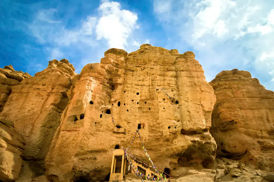
The region is shaped by Tibetan-influenced culture, monasteries, caves, prayer flags, dry cliffs, mountain settlements, isolated lifestyles, and the powerful Kali Gandaki corridor.

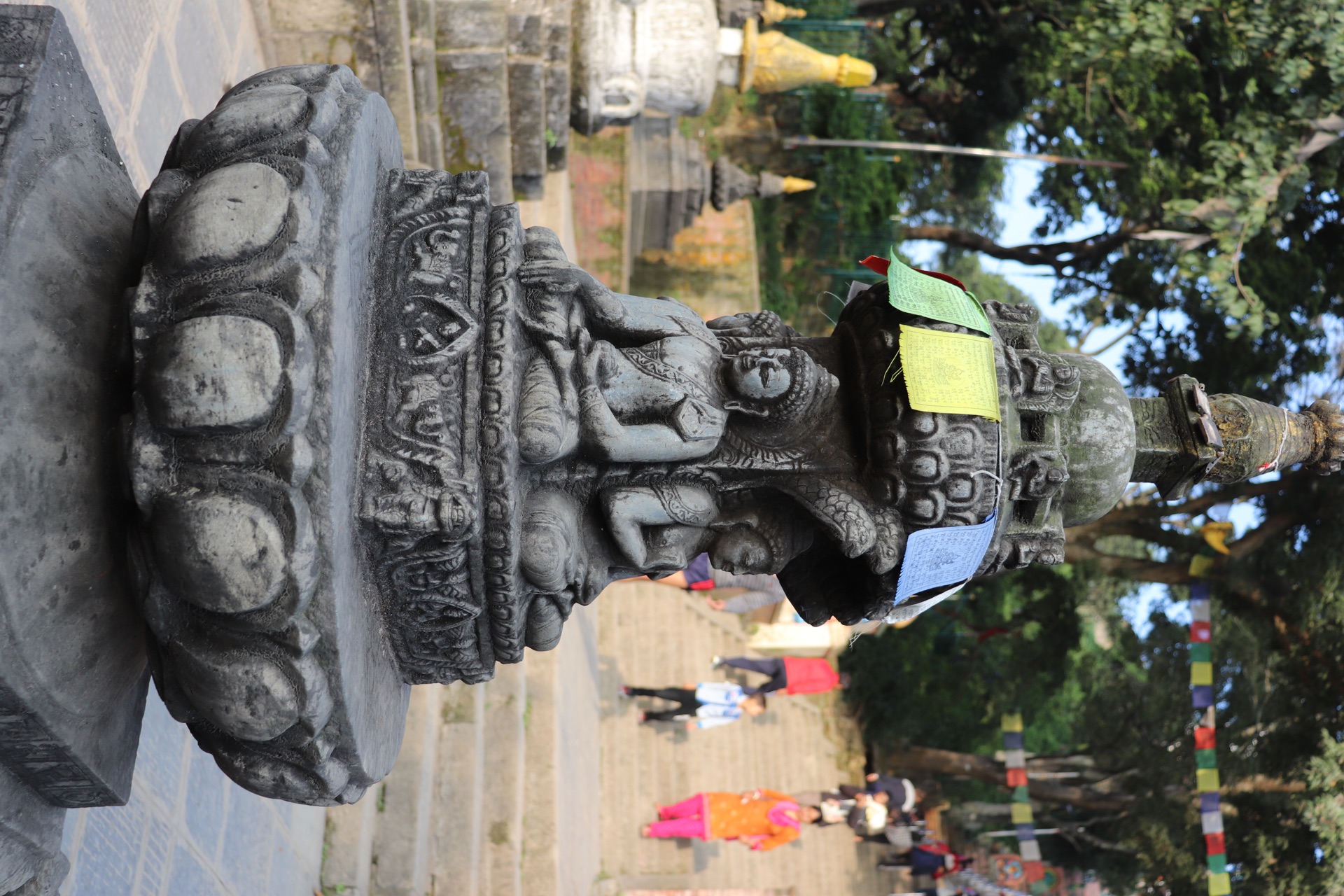
Tibetan-influenced settlements, monasteries, chortens, and prayer flags
Kali Gandaki Valley wind, riverbeds, dry cliffs, and canyon-like drama
Ancient caves and highland villages that feel isolated from ordinary travel routes
Himalayan desert terrain where color, dust, altitude, and silence shape the journey
Mustang caves and high desert Himalayan landscape

High desert identity

Dry cliffs, prayer flags, caves, settlements, and wind-shaped valleys.

Real road and weather conditions

The honest guide: Mustang can be dusty, windy, cold, rough, and unforgettable.

Trust comes from realism. Road condition, afternoon wind, altitude, landslide risk, winter cold, and monsoon damage should shape every Mustang plan.

Strong Afternoon Wind

Jomsom and open valley sections can become windy, dusty, and tiring later in the day.

Seasonal Road Damage

Rain, landslides, construction, and river crossings can affect access, especially around monsoon and shoulder periods.

Winter Cold

Winter travel can mean cold mornings, snow risk, closures, and tougher high-altitude comfort.

Altitude Effects

Even road travelers need to respect altitude, hydration, sleep, and fatigue.

Dust And Exposure

Face protection, eye protection, layers, and realistic daily distance matter for riders.

Best Months

March to May and September to November are usually the safest planning windows for most travelers.

Experience the journey

Ride deeper into remote Himalaya one decision at a time.

A Mustang journey is remembered through early starts, dusty mountain roads, tea stops, remote valleys, prayer flags in the wind, and sunset over canyon landscapes.

1

Leave Pokhara early while the lake city is still quiet.

2

Follow roughening roads toward river valleys and exposed mountain corridors.

3

Stop for tea in villages where dust, wind, and prayer flags share the same air.

4

Ride past dry cliffs, canyon landscapes, and wide Himalayan silence.

5

Watch sunset turn Mustang's desert mountains into copper and shadow.

6

Continue deeper only when permits, weather, road condition, and energy all make sense.

Practical travel information

Plan Mustang with road, altitude, permit, and comfort reality in mind.

The best Mustang trips are realistic. Confirm current permits, road conditions, fuel, transport, accommodation, signal, and seasonal access before locking the route.

Best Season

March to May and September to November are the main planning windows. Upper Mustang can work in monsoon, but road checks still matter.

Permit Requirements

Lower Mustang and Upper Mustang have different permit realities. Upper Mustang requires special restricted-area planning.

Recommended Duration

Plan 4 to 6 days for Lower Mustang from Pokhara. Add more days for Upper Mustang, Lo Manthang, or slower exploration.

Fuel Availability

Fuel exists on main corridors but should not be treated casually. Top up early and keep group rides conservative.

Road Accessibility

Jeep and bike access depends on weather, construction, landslides, and local road condition.

Accommodation

Expect lodges, guesthouses, and simple mountain comfort rather than polished resort standards.

Internet And Signal

Signal can be weak or uneven. Offline maps, saved bookings, and downloaded documents are important.

Transport Choices

Bike, jeep, bus, flight to Jomsom, or guided tours all change cost, comfort, risk, and flexibility.

Altitude Range

The journey can climb from Pokhara's low elevation to high settlements above 3,700 meters.

FAQ

Common questions about Mustang.

Short answers for planning Mustang road trips, bike rides, permits, and high-altitude travel.

What is Mustang famous for?

Mustang is famous for high-desert Himalayan landscapes, rough road journeys, Tibetan-influenced culture, Kali Gandaki Valley, Jomsom, Marpha, Kagbeni, Muktinath, Lo Manthang, ancient caves, and Upper Mustang exploration.

Is Mustang good for a bike trip?

Yes, Mustang is one of Nepal's most iconic bike-trip regions, but riders should prepare for dust, wind, rough road sections, altitude, limited services, weather changes, and long mountain-road days.

Do foreigners need permits for Mustang?

Foreign travelers need to check permit requirements carefully. Lower Mustang usually follows Annapurna-area permit logic, while Upper Mustang has restricted-area rules, higher permit costs, and guided travel requirements.

What is the best season for a Mustang road trip?

March to May and September to November are usually strong Mustang travel windows. Upper Mustang can also be considered in monsoon because of the rain-shadow effect, but roads and access should still be checked.

How many days are needed for Mustang?

Lower Mustang and Muktinath can fit into about 4 to 6 days from Pokhara. Upper Mustang and Lo Manthang usually need more time, stronger permit planning, and better buffers.

Travel utility checklist

Mustang travel planning essentials

Use these structured notes as a planning checklist, then verify seasonal conditions, transport, permits, and local services close to travel.

Last verified: 2026-07-09

Permit Information

Permit status

Check protected-area or restricted-area rules before travel

This site explains requirements, but official permit services remain the source of truth.

Documents to keep ready

Passport, visa, passport photos, and printed or offline permit copies where required

Transport Options

Route planning

Compare this stop with nearby places in the route planner

Transport certainty

Confirm road, flight, or trail access locally

Estimated Costs

Budget level

high

Stay length

4 days suggested by the destination dataset

Emergency And Health

Safety level

caution

Hospital information

Use local city hospitals or clinics; confirm nearest facility before remote side trips

Emergency contacts

Save Tourist Police and local operator or hotel contacts offline

ATM, Internet And SIM

ATM availability

Available in main towns or hubs

Carry enough cash before leaving a gateway town.

Internet and SIM

Mobile signal can vary by route and weather

Altitude, Weather And Seasons

Altitude

3,840 m

Best months

Mar, Apr, May, Sep, Oct, Nov

Weather check

Check current conditions before booking transport or trekking days

Packing Tips

Core packing

Layered clothing, rain protection, water bottle, offline maps, power bank, and copies of documents

Terrain note

Pack for longer walking days, weather shifts, and colder mornings

Nearby Places

Next step

Use related destination links and the route planner to connect this page into a wider itinerary

Travel warnings and verification notes

  • Do not treat estimated costs or permit summaries as official services.
  • Verify road, flight, trail, and weather conditions close to departure.

Smart route check

Plan Mustang by travel order, not just by popularity.

This is where Discover Nepal Hub is different: the goal is to reduce backtracking, missed nearby places, and confusing Nepal route choices.

Compare this route in the planner

Best route direction

Kathmandu or Pokhara -> gateway town -> mountain route: mountain destinations need staging, permits, weather checks, and exit buffers.

Useful next move

Mustang -> Muktinath: Muktinath is close enough to help build a cleaner regional route instead of adding a disconnected detour.

Mistake to avoid

Treating Mustang as a quick pin instead of matching it to your route sequence.

Destination decision panel

Decide if Mustang belongs in your Nepal itinerary.

Mustang is best understood through highland, road trip, culture experiences in Mountain Regions.

Best for

adventure travelers, photographers, culture seekers

Not ideal for

travelers whose route would require major backtracking for a short stop

Recommended stay

4 days or more

Budget level

Higher logistics cost

Difficulty level

moderate

Family suitability

Better for active families

Solo traveler suitability

Good with normal precautions

First-time Nepal visitor

Good with planning

Who should visit

Match Mustang to the right traveler type.

Photographers

Why it fits: Mustang rewards photographers who plan around morning light, weather, and the specific highland / road trip setting.

Why it may not fit: It may disappoint if the visit is squeezed into harsh midday light or poor visibility.

Culture seekers

Why it fits: Mustang fits travelers who want context, local rhythm, and respectful time around highland and road trip sites.

Why it may not fit: It may not fit travelers who only want quick photos without slower cultural attention.

Adventure travelers

Why it fits: Mustang works for adventure travelers when safety checks, weather, and operator quality shape the plan.

Why it may not fit: It may not fit travelers who want every activity confirmed regardless of conditions.

Premium or remote-route travelers

Why it fits: Mustang fits travelers willing to pay for smoother logistics, better timing, and stronger local support.

Why it may not fit: It may not fit strict budget travelers unless they accept slower transport and simpler stays.

Things to do

Practical activities for Mustang.

Jomsom or road access

Start with this because it reveals highland, road trip, culture experiences in Mountain Regions.

Time: Half day

Cost: Moderate to high

Best time: Clear-season morning

Tip: Confirm current permits, conservation-area rules, and checkpoint requirements before departure.

village and monastery stops

Use this to add depth beyond the main arrival point in Mustang.

Time: Half day

Cost: Moderate to high

Best time: Clear-season morning

Tip: Build buffer days for weather, road delays, flight delays, landslides, or altitude pacing.

wind-aware travel

Use this to add depth beyond the main arrival point in Mustang.

Time: Half day

Cost: Moderate to high

Best time: Clear-season morning

Tip: Use registered guides or reputable operators for high-altitude, remote, or restricted routes.

How to reach

From Kathmandu

Use the main trekking or road gateway for the region, then continue by flight, jeep, bus, or walking route as conditions allow.

From Pokhara

Pokhara is useful for Annapurna and Mustang routes, while Everest and Langtang usually work better from Kathmandu.

By flight

Flights can save time on some routes but need weather buffer days and flexible onward plans.

Where to stay

Gateway town

Stay here before committing to the trail or remote road section.

Route lodges

Expect simple rooms, variable showers, charging limits, and cash payments.

Common mistakes

  • treating Mustang as a quick pin instead of matching it to your route sequence.
  • forgetting cash for small tickets, local transport, snacks, tips, toilets, or remote payments.
  • arriving too late in the day and losing the best light, transport window, or activity timing.
  • trusting map distance without checking real road time, traffic, trail condition, or weather.

Local food and experiences

Local meals

Choose busy local places and ask your stay for regional dishes rather than relying only on tourist menus.

Morning walk

Most towns reveal more before traffic, heat, and transfer pressure build.

Festival timing

Local festivals can deepen the visit, but transport and accommodation need earlier planning.

Destination connections

Kathmandu or Pokhara -> gateway town -> mountain route

mountain destinations need staging, permits, weather checks, and exit buffers.

Mustang -> Muktinath

Muktinath is close enough to help build a cleaner regional route instead of adding a disconnected detour.

Mustang -> Annapurna Region

Annapurna Region is close enough to help build a cleaner regional route instead of adding a disconnected detour.

Trip planning insights

The decisions to make before booking Mustang.

How many days should I stay?

4 days or more is the practical first-plan answer. Add time if Mustang is part of a longer route, weather-dependent activity, trekking stage, or remote transfer.

When should I skip this destination?

Skip it if adding the stop creates backtracking without giving you enough time to experience the place properly.

What season is best?

Mar, Apr, May, Sep, Oct, Nov are the easiest months for a comfortable visit. Outside these months, plan around heat, rain, haze, or reduced visibility.

Can it be visited year-round?

Usually yes, but the quality of the visit changes by season. In hotter or wetter months, start early and keep the route lighter.

What type of trip benefits most?

Mustang works best in a trip built around adventure travelers, photographers, culture seekers rather than a route that adds stops only because they look close on a map.

Cookie choices

Essential storage keeps this choice. Analytics cookies only load if you accept them. Read the privacy policy.