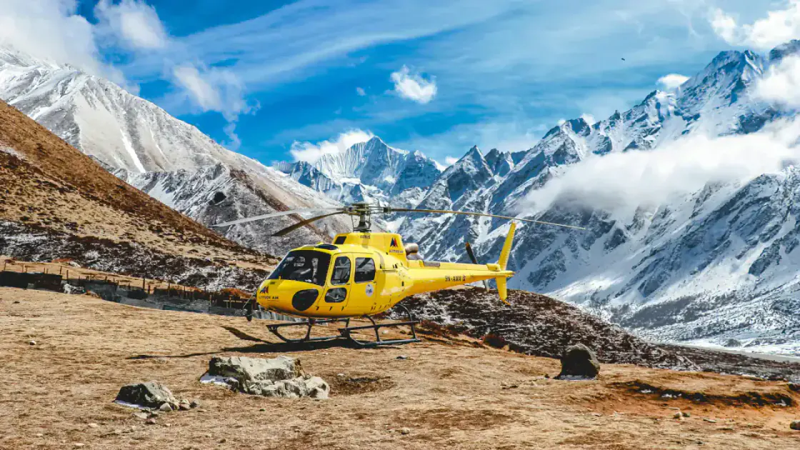
Langtang Region
Langtang Valley Trek Guide
A compact Kathmandu-access trek through Tamang villages, forest, river valley, Kyanjin Gompa, yak pastures, and optional high viewpoints.
Region
Langtang Region
Duration
6-9 days
Difficulty
Moderate
Best season
Mar-May and Oct-Nov
Max altitude
4,984 m at Tserko Ri
Route overview
How the Langtang Valley route usually flows.
Langtang usually begins with a road journey from Kathmandu to Syabrubesi, then follows the valley through Lama Hotel, Langtang village, and Kyanjin Gompa.
The trek is shorter than Everest or Annapurna routes but still reaches serious altitude if you hike Kyanjin Ri or Tserko Ri.
It suits travelers who want Himalayan scale without a domestic mountain flight.
Day-by-day itinerary
A practical starting itinerary.
Treat this as a planning frame, then adjust for weather, fitness, guide advice, and available lodges.
Day 1
1,460 m
Kathmandu to Syabrubesi
Mountain road transfer
A long road day starts the trip; keep expectations flexible.
Day 2
2,470 m
Syabrubesi to Lama Hotel
River and forest trail
Enter the valley with steady climbing through forest.
Day 3
3,430 m
Lama Hotel to Langtang village
Open valley ascent
Mountain views widen as the valley opens.
Day 4
3,870 m
Langtang village to Kyanjin Gompa
Yak pastures and monastery area
Reach the main upper valley base.
Day 5
4,773-4,984 m
Kyanjin viewpoint day
Kyanjin Ri or Tserko Ri option
Choose a high viewpoint only if weather and acclimatization feel right.
Day 6
2,470 m
Kyanjin Gompa to Lama Hotel
Return valley descent
Descend through familiar settlements and forest.
Day 7
1,460 m
Lama Hotel to Syabrubesi
Forest and river trail
Finish the walking route.
Day 8
1,400 m
Syabrubesi to Kathmandu
Road transfer
Return to Kathmandu with a road buffer if possible.
Permit Information
Langtang National Park permit
Required for the protected area and checked along the access route.
TIMS or local trek registration
Confirm the latest registration rule in Kathmandu before departure.
Cost Expectation
Budget tea-house style: USD 25-45 per day
Simple lodges, meals, permits, and shared road transport.
Guided style: USD 50-90 per day
Guide support, arranged logistics, and more comfortable pacing.
Road and permit buffer: USD 50-120+
Depends on private/shared transport and current permit fees.
Difficulty And Fitness
Moderate fitness is enough for the core valley route, but optional viewpoints are demanding because they climb near or above 4,700 m.
Best Time To Go
Spring and autumn are the main windows. Winter can be cold but quiet, while monsoon brings leeches, rain, road disruption, and reduced mountain visibility.
Transport Access
The practical access is by jeep or bus between Kathmandu and Syabrubesi. Road time can be long, rough, and weather affected.
Travel utility checklist
Langtang Valley trekking essentials
Use this as the reusable trek checklist for permits, transport, cost ranges, altitude, emergency planning, and official references.
Last verified: 2026-07-09
Permit Information
Langtang National Park permit
Required for the protected area and checked along the access route.
Confirm current requirements with official sources or a licensed trekking agency before departure.
TIMS or local trek registration
Confirm the latest registration rule in Kathmandu before departure.
Confirm current requirements with official sources or a licensed trekking agency before departure.
Transport Options
Access
The practical access is by jeep or bus between Kathmandu and Syabrubesi. Road time can be long, rough, and weather affected.
Estimated Costs
Budget tea-house style
USD 25-45 per day
Simple lodges, meals, permits, and shared road transport.
Guided style
USD 50-90 per day
Guide support, arranged logistics, and more comfortable pacing.
Road and permit buffer
USD 50-120+
Depends on private/shared transport and current permit fees.
Emergency, Hospital And Altitude
Max altitude
4,984 m at Tserko Ri
Fitness
Moderate fitness is enough for the core valley route, but optional viewpoints are demanding because they climb near or above 4,700 m.
Hospital information
Identify the nearest health post, HRA aid post, or evacuation plan before starting high-altitude sections
ATM, Internet And SIM
Cash planning
Carry enough cash after leaving the gateway town; ATM reliability is not guaranteed on trail
Internet and SIM
Expect mobile data and lodge Wi-Fi to vary by valley, altitude, weather, and power availability
Weather And Seasonal Notes
Best season
Mar-May and Oct-Nov
Best time detail
Spring and autumn are the main windows. Winter can be cold but quiet, while monsoon brings leeches, rain, road disruption, and reduced mountain visibility.
Packing Tips
Core trek packing
Warm layers, rain shell, broken-in boots, sun protection, water treatment, headlamp, power bank, and offline permit copies
Safety notes
Do not underestimate road delays between Kathmandu and Syabrubesi. Add a rest or short day if altitude symptoms appear near Kyanjin. Use local lodge advice for viewpoint weather and snow conditions. Carry enough cash because ATM access is limited on the trek.
Nearby Places
Langtang
Main destination guide for the valley and national park.
Kathmandu
Arrival, permit, gear, and road-transfer base for Langtang.
Travel warnings and verification notes
- Permit, guide, and route rules can change; confirm before paying for a fixed plan.
- Altitude illness can become serious. Do not ascend if symptoms worsen.
Official government and tourism references
Discover Nepal Hub explains the planning context and links out to official sources. It does not replace government or permit services.
Safety notes
Build safety into the plan before the trail starts.
Do not underestimate road delays between Kathmandu and Syabrubesi.
Add a rest or short day if altitude symptoms appear near Kyanjin.
Use local lodge advice for viewpoint weather and snow conditions.
Carry enough cash because ATM access is limited on the trek.
Related places
Destination pages connected to this trek.
Route planner
Connect Langtang Valley with the rest of your Nepal route.
Use the planner to compare arrival bases, recovery days, and nearby destination pages before fixing your schedule.